Postcards from Apgar Village Lodge

At $100 per night, these rustic cabins inside Glacier National are a bargain. Located at the southern tip of Lake McDonald, Apgar Village Lodge is a great place to stay a few nights while exploring the west side of the park. 

The highlight of my stay was waking up around dawn each morning, getting a free cup of coffee at the lodge office, and watching the sun rise over Lake McDonald. 

The reflections of the snow-capped mountains surrounding the lake would change as morning became afternoon. 

In the evening, the brilliant reflections faded to dark. With little light pollution, the stars and moon lit up the night sky. 

Here are a few photos I took while staying at the lodge. 

The entrance to our cabin.

Our room had a view of a river that ran near the lake.

The room didn’t have a TV or wifi. To me, that was one of the perks.

Hiking the Avalanche Lake Trail

Since I visited Glacier National Park in May, many of trails were still closed because of snow and ice. 

However, I was able to hike one of the most popular trails in the park: the Avalanche Lake Trail. 

The 4.6-mile (roundtrip) trail cuts through thick woods, with moderate climbs in elevation. The highlight is the lake, which is rimmed with steep cliffs on three sides. 

The melting snow in late spring/early summer creates several waterfalls, which send water cascading down the cliffs.  

It’s a must-see for any visitor to the park.  


Why I bought bear spray, and maybe you shouldn’t 

If you google “things you need to know before visiting Glacier National Park,” the first link that appears includes a reminder that you’re in grizzly bear country.  

Entering the park, the signs are everywhere: “Bear Country: All Wildlife Is Dangerous Do Not Approach Or Feed.” 

My wife and I were on the fence about buying bear spray, but talked ourselves into it after overhearing a conversation a forest ranger had with a local convenience store owner. 

Store owner: Busy lately? 

Ranger: Actually, yes. We’ve had quite a few bear sightings. I always tell people to carry bear spray. You pay for life insurance, and this is a form of insurance. 

Store owner: I’ve been hiking this area for 30 years and always carry it with me.     

So, we bought a can. I shopped around a bit and found one for $45, which seemed like a bargain given the prices of “higher-end” options. It came with a holster that I could fasten to my jeans, making the can, in theory, easily accessible at a moment’s notice. 

Signs all around Glacier National Park warn visitors that they are entering bear country.


A pun-laden manual that came with the spray — “Bear Safety Tips: Bear in Mind the Information — recommended testing it before hiking. 

“Test fire downward,” the manual states. “Outside pointed safely away. Contents may travel and/or linger longer than expected. Using a quick half-second burst will increase safety and confidence with this product.” 

A footnote in the manual explained that exposing your eyes to the spray could cause “irreversible damage.” 

Given that the odds of me accidentally spraying into the wind and subsequently blinding myself were much greater than getting attacked by an actual bear, I skipped the practice test. 

Instead, in an empty parking lot, I practiced pulling the can from the holster and firing at an imaginary beast until I got comfortable with the maneuver. 

I did some shopping around, but ultimately settled on this bear spray.

And so, spray can in tow, we went into the wilderness. We didn’t encounter any bears on that hike … or any other in the park. That’s the norm, of course, as sighting are rare and attacks even rarer.

I know it’s a “form of insurance,” as the ranger put it, but I couldn’t help but think I had wasted my money. If a bear charges you in the wild, the spray might not even help. The bear spray manual clearly states that more than once.

(“Although nothing is 100 percent guaranteed effective,” the manual says, “here are some tips that might prove to be useful in an encounter.)

Here’s a tip that might prove useful when considering whether to buy bear spray: if you’re not comfortable practicing because you’re afraid you might shoot yourself in the face, take your chances in bear country without it.    

The glory of Glacier National Park

Hiking through the wilderness wonderland that is Glacier National Park, I couldn’t help but think of the conservationists who had the foresight to preserve these lands. 

After President Teddy Roosevelt helped establish national parks in the Dakotas, Oregon, Colorado and California in the 1900s, an explorer named George Bird Grinnell pushed the federal government to add Glacier to the list. 

In 1910, Roosevelt’s successor, President William Howard Taft, signed a bill that did just that, making Glacier the country’s 10th national park. That action preserved over a million acres of forest, lakes, rivers and glaciers that visitors still enjoy today.

I didn’t come face-to-face with any glaciers; the roads and trails that led to them were still closed because of a late spring snowfall. 

But I did see a moose taking an afternoon dip in a lake; mountain goats holding up traffic as they scurried about a rural road; and, thousands of feet above me, streams of water racing down cliffs glistening in the sunlight. 

There are several lookout points along Going-to-the-Sun Road, a 50-mile route that spans the width of the park between the west and east entrances.

For the most part, I didn’t have a cellphone signal in these areas. My instant gratification consisted of new discoveries around each corner, whether it was bugs splatting onto my windshield, or a snow-capped mountain stretching into the sky. 

That was part of the thrill: Seeing unspoiled nature and animals in their environment, as Roosevelt and Grinnell would have witnessed it over a century ago.

Glacier National Park was established in 1910.

The park is home to more than 700 miles of hiking trails.

When I visited the park earlier this month, many of the roads were still closed because of snow and ice.

Glacier National Park has many options for lodging, from campsites to high-end hotels.

A man fishes in a river near the St. Mary Falls trail.


The park has more than 200 waterfalls.

Postcards from Boulder 

I recently visited Boulder, Colo., and now I understand why people are flocking there in droves. The scenery is amazing, and the food scene – for the size of the town – is great.

Boulder is located around 30 miles southeast of Denver.

People from all over the world come to Boulder to hike the trails surrounding the city.

Patches of snow can still be seen in early March near a lake outside Boulder.

As Mount Rushmore turns 75, Crazy Horse memorial still far from complete

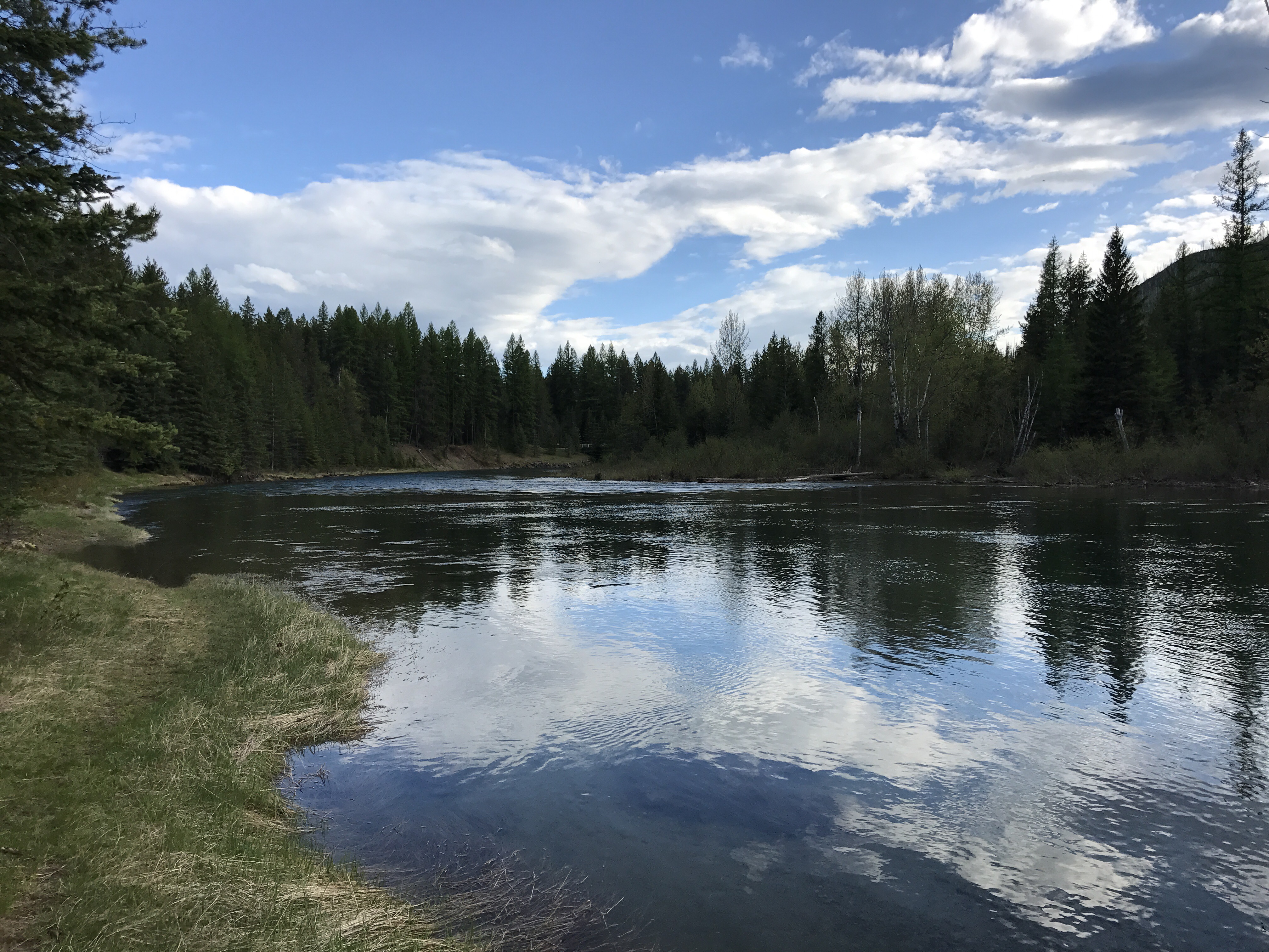
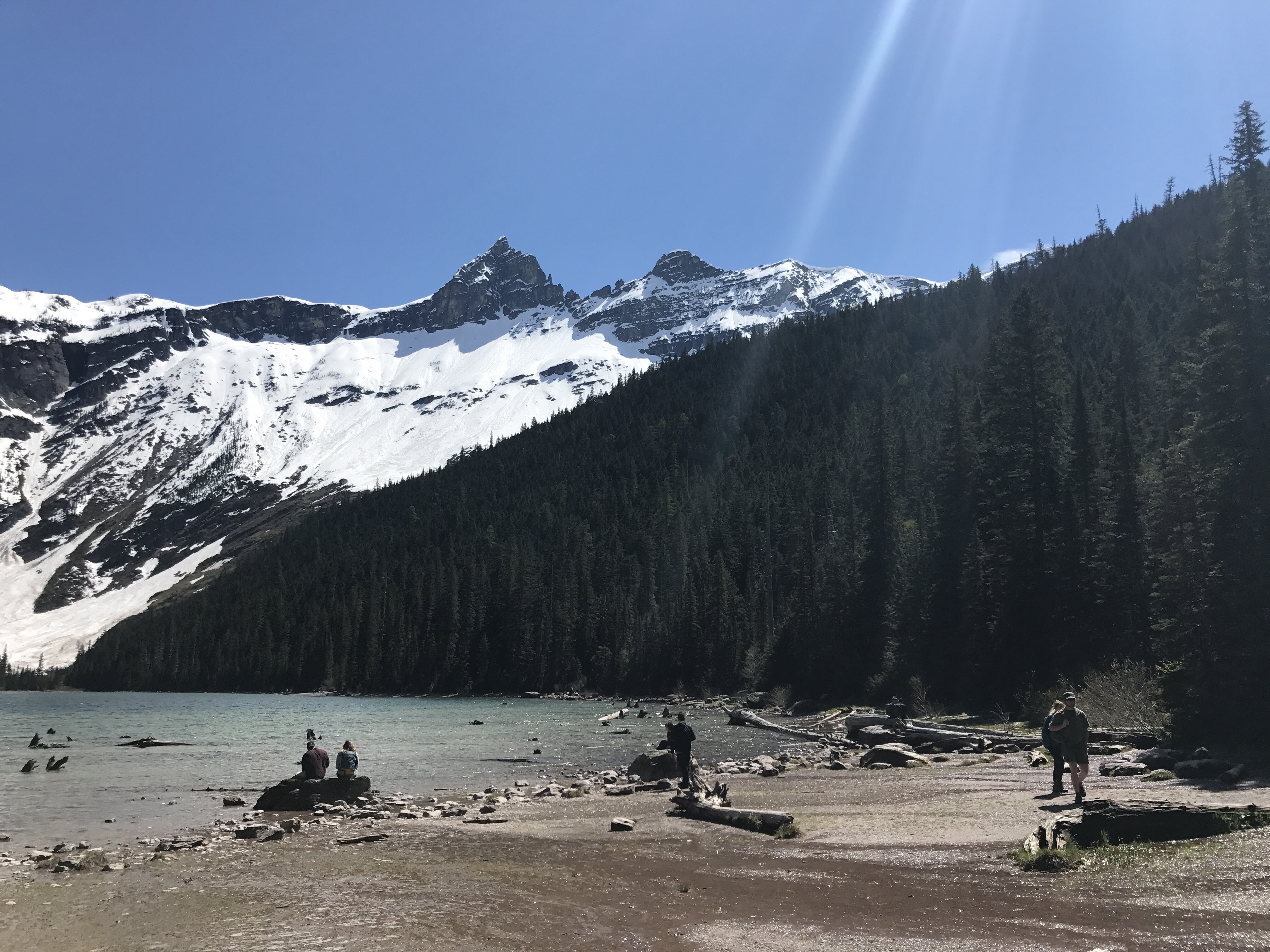
One of the world’s most recognizable stone monuments is practically in my backyard. Twenty-three miles southeast of Rapid City lies Mount Rushmore, a national memorial to four of the nation’s presidents: George Washington, Thomas Jefferson, Abraham Lincoln and Theodore Roosevelt.

They are arguably four of the country’s most important presidents. Washington led the successful war effort against the British that gave the United States independence and later served as the nation’s first president. Jefferson was the primary author of the Declaration of Independence and advocated for religious freedom and tolerance. Lincoln guided the Union through some of its darkest and bloodiest days during the Civil War, when the country’s north and south states were anything but united. Roosevelt’s greatest legacy may be the efforts he undertook to protect wildlife and public lands by establishing the United States Forest Service.

These men laid the foundation for the prosperity Americans enjoy today. But for the Native people of this land, that prosperity meant an end to their way of life. Their territory became smaller and smaller, until they were forced to live on reservations established by the government through treaties that were often unfair. The American bison, which many tribes depended on for food, tools and shelter, was nearly hunted to extinction.

There was resistance among Indian nations to U.S. military efforts to expand westward, but as the soldiers’ firearms became more accurate and lethal the battles became more one-sided.

One of those resistors was an Oglala Sioux Chief, Crazy Horse, who defeated George Armstrong Custer’s Seventh Cavalry in June 1876 at the Battle of Little Bighorn in Montana Territory. More than 250 members of the Seventh Calvary were killed in the battle, including Custer.

Following the battle, the military hunted down Crazy Horse, and less than a year later he surrended in Nebraska and was taken to Fort Robinson, where he died after being stabbed during a scuffle with soldiers.

Today, Crazy Horse is memorialized on a stone mountain, just 16 miles west of Mount Rushmore. While the memorial to the presidents was carved in just 14 years, the Crazy Horse memorial, started in 1947, remains a work in progress.

img_0015

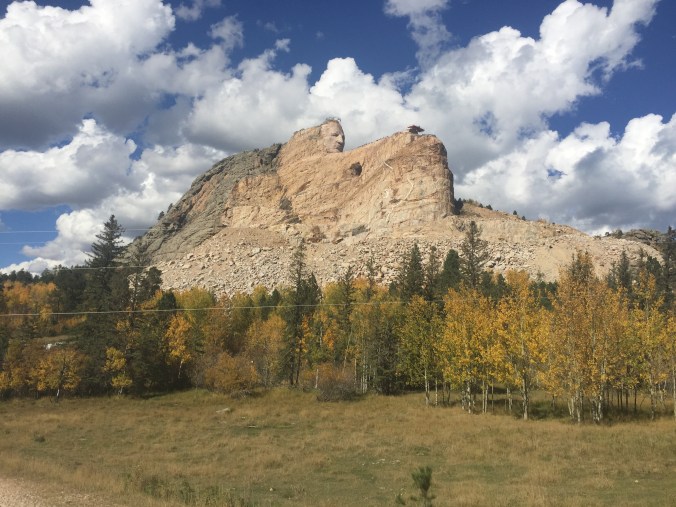
Korczak Ziolkowski began working on the Crazy Horse Memorial in 1947.

img_0016

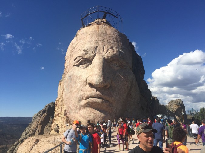
The head alone is 87-feet tall.

img_0014

Once it’s finished, the memorial will become the largest sculpture in the world.

img_0011

Signs near the memorial warn visitors to listen for blasting signals. 

His face is complete, but Crazy Horse’s arm (263 feet wide) and his horse’s head (219 feet tall) have yet to take shape. White paint on the mountainside outlines the spots where construction crews will blast away rock to carve the horse’s head.

Perhaps the main reason the project has taken so long is, unlike Mount Rushmore, the Crazy Horse memorial has received no federal funding and instead relies on donations and revenue from admissions.

I was able to get an up-close look at the memorial last weekend during the biannual Volksmarch, a spring/fall hike that takes visitors more than 6,000 feet above sea level to Crazy Horse’s 87-foot-tall head. It’s one of only two times a year that the public is allowed to hike up to the head.

When viewed from a few feet away, its size is staggering. The chin alone is the size of a basketball goal.

Once it’s finished, the memorial will become the largest sculpture in the world, taller than the presidents’ faces at Mount Rushmore.

But the timetable for completion remains unclear.

Korczak Ziolkowski, who started the sculpture, died in 1982. His wife, Ruth Carolyn Ziolkowski, took over management of construction efforts. Under her watch the memorial became one of the top tourist draws in South Dakota, attracting more than 1 million visitors a year.

Ruth died in 2014, and today her grandchildren and children continue the work that her husband started almost 70 years ago.

In a 2012 interview with the New York Times, Heidi Ziolkowski, one of the couple’s two dozen grandchildren, said she wonders whether she’ll live long enough to see the project finished.

The final work on the Mount Rushmore National Memorial was completed on Oct. 31, 1941, and throughout this year there have been several events to celerate its 75th anniversary.

If you believe Heidi Ziolkowski, who was 24 at the time she was interviewed, it could be half a century or more before the Crazy Horse Memorial celebrates its first.

The ‘crown jewel’ of Custer State Park

One of the first places I was told to visit after moving to Rapid City was Sylvan Lake.

It took a few months, but I finally made it there over the weekend. This majestic body of water, located high in the Black Hills and about 45 miles southwest of Rapid City, is considered the “crown jewel” of Custer State Park.

It’s easy to see why: I had planned on jogging the one-mile loop trail that takes you around the lake, but instead walked at a leisurely pace to admire the tall rock formations that sit at the edge of the water.

A word of wisdom to first-time visitors: Bring a hat or wear sunscreen. The lake sits at an elevation of 6,145 feet and the sun is intense, even in the cooler months of the year.

IMG_7086

A devil of a hike

“How much farther do we have to go?” a young boy asked, as he passed me with his family while I descended from Little Devils Tower, elevation 6,908 feet.

“Is it like 35 feet?”

“Thirty-five plus a couple of zeros,” I responded.

His dad chucked, but the kid didn’t get my joke. “You still have a ways to go,” I told him.

Perhaps it was the elevation. Perhaps my lungs are still recovering from five years in Beijing, which at times felt like living in a smoking lounge. Perhaps I’m just out of shape.

The Black Hills, in southwestern South Dakota, is full of beautiful rock formations.

The trail to Little Devils Towers is around 3 miles out and back.

People come from all over the world to rock climb in the Black Hills.

Whatever the reason, I had to stop several times to catch my breath along the winding and rocky path to the summit of Little Devils Tower, one of the highest peaks in the Black Hills. The occasional breaks allowed me to take in the magnificent giant rock formations, which jut into the sky from the mountaintop.

The name of the place, Little Devils Tower, is misleading because there’s really nothing little about it. At nearly 7,000 feet, it’s one of the highest points in the United States east of the Rocky Mountains.

On a clear day, it is said you can see more than 100 miles out onto the horizon from the highest peaks in the Black Hills.

Little Devils Tower is located in Custer State State Park.

The skies were mostly clear when I visited. From the summit, you can see the spot where the hilly terrain ends and the high plains begin.

The last leg of the journey to the top is the most difficult. The dirt trail gives way to rocks and boulders, and I had to pause a few times to figure out the best way to climb over them safely. A series of blue markers posted on tree trunks and rocks help you stay on the path, but it’s easy to get sidetracked if you’re not paying attention.

A view from the summit, elevation nearly 7,000 feet.

From the trailhead, I was able to reach the summit within a couple of hours. It’s an easy hike to finish in an afternoon, unless, of course, you’ve got a kid in tow who asks “Are we there yet?” every 35 feet.

Behold Bohol’s otherworldly Chocolate Hills

One of the more unique landscapes in the Philippines can be found in Bohol province, home of the Chocolate Hills.

The hills, which range in height from 40 to 120 meters, jut out of the ground like camel humps. Scientists say they were formed by the “uplifting of ancient coral-reef deposits, followed by erosion and weathering,” according to Lonely Planet.

DSC_0113

This phenomenon can only be found in two or three other places in the world (one of those places being the island of Java, in Indonesia). Continue reading

Sitting on top of the world — almost

On my last day in Shangri-La, I hiked to the top of a hill overlooking the city. The incline wasn’t steep, but every 20 paces or so I had to stop to catch my breath. The city has an altitude of 3,200 meters, and my body still hadn’t completely adjusted to the elevation.

Along the hike, I passed several tombs that had been dug into the hillside. Some were very elaborate, with sculptures of lions and carvings of people dressed in ethnic attire. I assume families chose this spot as their loved ones’ final resting place because of the view. From the hill you can see a giant golden prayer wheel – the largest in the world – and rows of mountain peaks that grow taller as you look farther into the horizon. Continue reading